Manaslu Region Trekking Information
June 21, 2024 admin
Manaslu Region Trekking
Manaslu region trekking destination located within Nepal Mid-West Himalaya around high and north of Gorkha district, which is halfway driven from Kathmandu and Pokhara highway.
This trekking destination is one of the most scenic and cultural trip to venture for more than ten days to two-week duration as per your time allows, which can be extended for more days or making it much shorter where overland journey involves reaching the trekking point towards high Manaslu region.
Manaslu Region Trekking: Starting Point
Manaslu region trekking starts by taking a drive from the capital Kathmandu on the interesting busy highway past many farm villages and town and then route diverts towards Gorkha area to reach low warm farm country of Arughat town.
Arughat town
Arughat located within semi-tropical temperature climate enriched with the agriculture of paddy and other crops where walk follows the raging Budhi Gandaki River fed from the glacier of Mt. Manaslu and its adjoining peaks. Where walk follows the river upstream past Soti, Maccha-Khola, Tatopani (a place with hot natural spring) unto Philm and Jagat villages with overnight stops in these nice villages where you can observe the local hill people various mid cultures of Hindu and Buddhism religions.
As walk progress heading much higher entering into cool alpine hills within the forested surrounding of tall rhododendron-pines-oaks-magnolia and fir tree lines then reaching high and scenic Manaslu valley, where landscapes, vegetation as well the culture dramatically changes as walk leads closer to the high mountainous area.
An interesting part of the walk is walking through nice villages of Dyang-Namrung-Bihe, Lo-Gaon with Sama-Gaon and Samdu enriched with strong Buddhist religion similar to Tibetan traditions and custom as the area situated close to the border of Tibet just across Samdu and Larke Phedi.
Manaslu region trekking takes you much higher after enjoying times with scenic views of mighty Manaslu range of mountains along with Ganesh Himal towards east direction, a great walk visiting and exploring local villages adorned with old heritage way of farm life in close vicinity of high mountains.
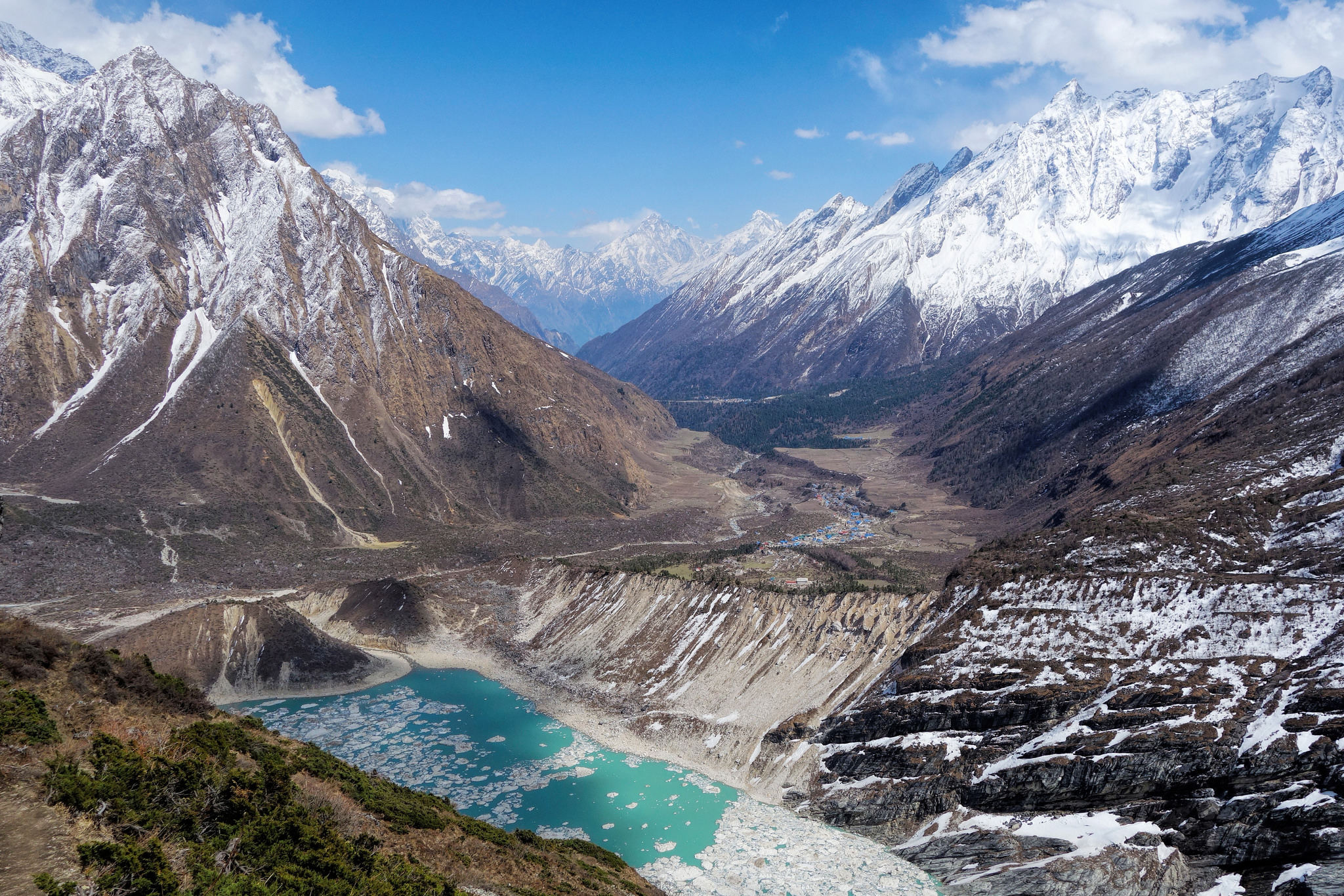
Manaslu valley
Around high Manaslu valley where tree lines and green vegetation disappears for only short bushes of dwarf rhododendron -juniper bushes with prickly Burberry shrubs as walk enters arctic zone of ice and glaciers at Larke Phedi, also called Dharmasala (resting spot with shades where at present provides few simple good lodges) as well called Larke Bazaar in earlier days.
With an overnight stop at Larke Phedi and Dharmasala after leaving the last village of Samdu, where climb leads you to the highest spot on top Larke-la pass at above 5,106 m which you can witness on a board, festooned with thousands of Buddhist Prayer flags that marks the top of Larke-la.
Enjoy spectacular views of Manaslu Himal range of peaks includes Bouddha-Sringi and Himal-Chuli with Ganesh Himal towards the east as well facing views of some Annapurna peaks and mountains of high Manang the Himlung Himal further northwest direction.
Bhimthang walk
From the high top of Larke-la descend on a long path to reach at the bottom of the hill past some icy frozen ponds to reach back into the green forest of tall pines-firs and rhododendron tree lines to reach at Bhimthang, a small settlement within a large grassy field surrounded by forest.
After Bhimthang walk leads into the pristine forest on a narrow path past cattle and Yak herders temporary shelters of small huts and shades within green meadow towards a small place of Gho, where walk takes you to large Tilje village and at Dharapani village above Marysangdi River.
Dharapani village
Dharapani and Tilje situated within Manang district all the way to Bhimthang after crossing Larke-la pass, Dharapani a large and spread-out village which is on famous and popular Annapurna Circuit route. Where the motorable road has reached to make it easier and shorter treks, however, trekkers can take a choice walking as far to Jagat or Syange village or take a drive from Dharapani village to reach Kathmandu or to Pokhara city.
Manaslu Region trekking historical and cultural background:
Manaslu region was closed to the outside world for many years after the first conquest of Mt. Manaslu by Japanese Expeditions in May 9th 1956 with team members T. Imamishi, K Kato, M. Higeta and Gyalzen Norbu Sherpa (Nepalese).
Due to its closeness to the Tibet border, the government closed and restricted the area of Upper Manaslu after China took over Tibet in the early 1960s. In the early days, strong trade between the two countries earned the area the name Larke Bazaar at the base of the Larke-la pass.
Trade still exists but in smaller ways where the actual height of Mt. Manaslu stands at 8,163 meter and 26,781 ft high, the mountain named Manaslu comes from ancient Hindu Sanskrit word as Manas which means Mind or Soul of the God (similar to Holy Lake Manasarovar in Tibet).
While the local word is Kutang for Manaslu comes from Tibetan origin language, as the native people of Manaslu are of strong Tibetan Buddhism with similar colorful culture and custom with traditional farm life and cattle and Yak herding and breeding as traditional heritage life.
Manaslu Region Routes and accommodation:
Manaslu Region Trekking has three routes of doing it either walk straight from Arughat town onward following Budhi Gandaki River all the way to reach a high Manaslu valley.
The other route with a combination of Tsum Valley with Manaslu Circuit Trekking where the walk starts on the same trail till Dyang, then head towards further northeast to Tsum Valley to high Mu Gompa and return to join at Lokpa village and continue to walk around Manaslu trekking.
The other route will be on less ventured route doing clock-wise walking from Dharapani village on a reverse from popular way, then crossing Larke-la from Bhimthang to reach downhill at Arughat town.
Seasons for Manaslu Region Trekking:
Snow might cover the high Larke-la pass in the Manaslu region during early spring, late autumn, and winter months.
The best time to visit is from April to May and September to mid-November. By late November, as the cold sets in, locals migrate to warmer areas, leading to the desertion of most lodges and villages.


